


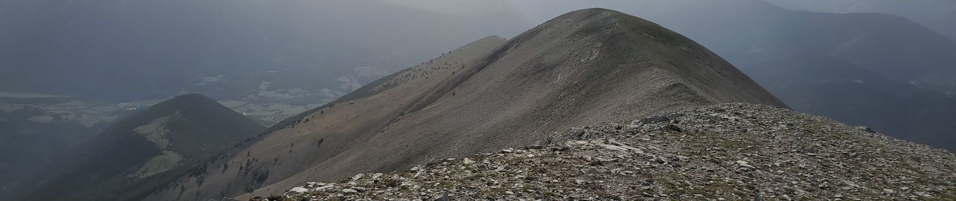
Chavailles col du talon mourre frey 1106m 13kms

Danielba
User GUIDE
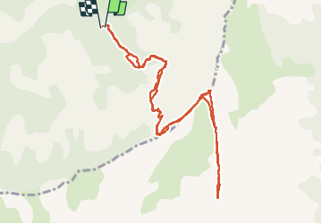

Length
12.1 km

Max alt
2275 m

Uphill gradient
1054 m
Km-Effort
26 km

Min alt
1225 m

Downhill gradient
1062 m
Boucle
Yes
Creation date :
2024-11-05 07:44:38.02
Updated on :
2024-11-05 16:54:47.031
6h42
Difficulty : Medium

FREE GPS app for hiking
 SityTrail
IGN / Geographical institutes
SityTrail Plus
The world is yours!
About
Trail Walking of 12.1 km to be discovered at Provence-Alpes-Côte d'Azur, Alpes-de-Haute-Provence, Prads-Haute-Bléone. This trail is proposed by Danielba .
Photos


Positioning
Country:
France
Region :
Provence-Alpes-Côte d'Azur
Department/Province :
Alpes-de-Haute-Provence
Municipality :
Prads-Haute-Bléone
Location:
Blégiers
Start:(Dec)
Start:(UTM)
297159 ; 4892390 (32T) N.
Comments