


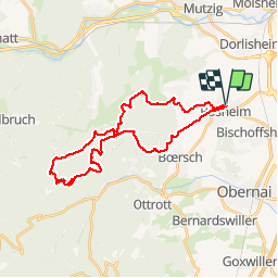

13.6 km | 17.9 km-effort


User


FREE GPS app for hiking
 SityTrail
IGN / Geographical institutes
SityTrail World
The world is yours!
Trail Mountain bike of 29 km to be discovered at Grand Est, Bas-Rhin, Rosheim. This trail is proposed by raphnou.
Tracé du Schnacker Tour Le Grand 8 2015
très difficile après la pluie car beaucoup de boue, donc à éviter après une période de pluie si vous n'aimez pas la boue ;-)

Walking

Walking

Walking

Walking

Walking

Walking
Mountain bike

Mountain bike
Horseback riding
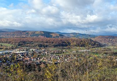
belle balade, dommage que les sangliers et les forestiers aient massacré le chemin large qui monte au heidenkopf. quelques beaux points de vue sur la vallée depuis les vignes. chouette parcours et roulant, mais j'en ai bavé ;-)