


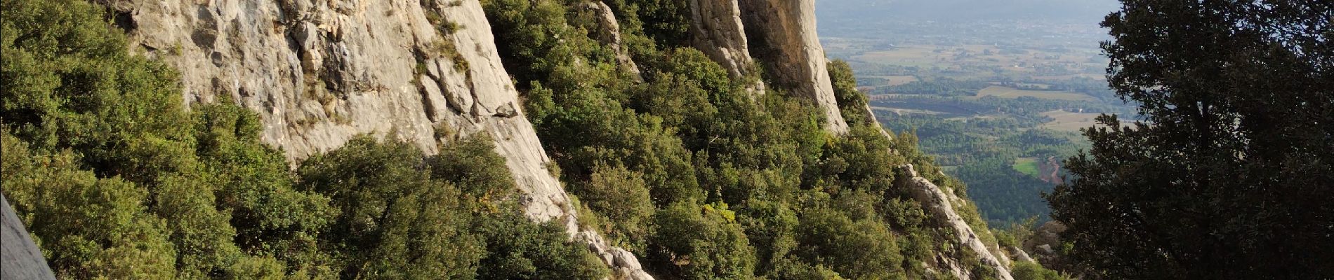
Pic des Mouches

cousam
User
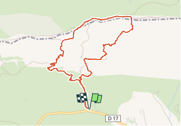

Length
5.8 km

Max alt
998 m

Uphill gradient
594 m
Km-Effort
13.7 km

Min alt
405 m

Downhill gradient
593 m
Boucle
Yes
Creation date :
2024-11-08 09:11:48.626
Updated on :
2024-11-09 05:56:58.178
5h25
Difficulty : Difficult

FREE GPS app for hiking
 SityTrail
IGN / Geographical institutes
SityTrail Plus
The world is yours!
About
Trail Walking of 5.8 km to be discovered at Provence-Alpes-Côte d'Azur, Bouches-du-Rhône, Puyloubier. This trail is proposed by cousam.
Photos


Positioning
Country:
France
Region :
Provence-Alpes-Côte d'Azur
Department/Province :
Bouches-du-Rhône
Municipality :
Puyloubier
Location:
Unknown
Start:(Dec)
Start:(UTM)
713605 ; 4822849 (31T) N.
Comments