


tentative Haute Cime

newman
User
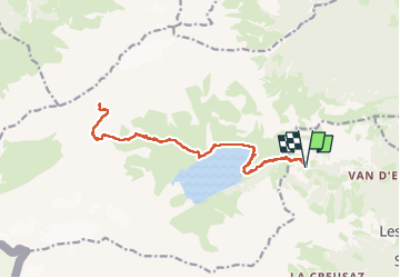

Length
18.7 km

Max alt
2868 m

Uphill gradient
1412 m
Km-Effort
38 km

Min alt
1512 m

Downhill gradient
1414 m
Boucle
Yes
Creation date :
2024-09-07 08:50:46.041
Updated on :
2024-11-10 12:07:02.426
5h09
Difficulty : Very difficult

FREE GPS app for hiking
 SityTrail
IGN / Geographical institutes
SityTrail Plus
The world is yours!
About
Trail Walking of 18.7 km to be discovered at Valais/Wallis, Saint-Maurice, Salvan. This trail is proposed by newman.
Positioning
Country:
Switzerland
Region :
Valais/Wallis
Department/Province :
Saint-Maurice
Municipality :
Salvan
Location:
Unknown
Start:(Dec)
Start:(UTM)
344491 ; 5111792 (32T) N.
Comments