


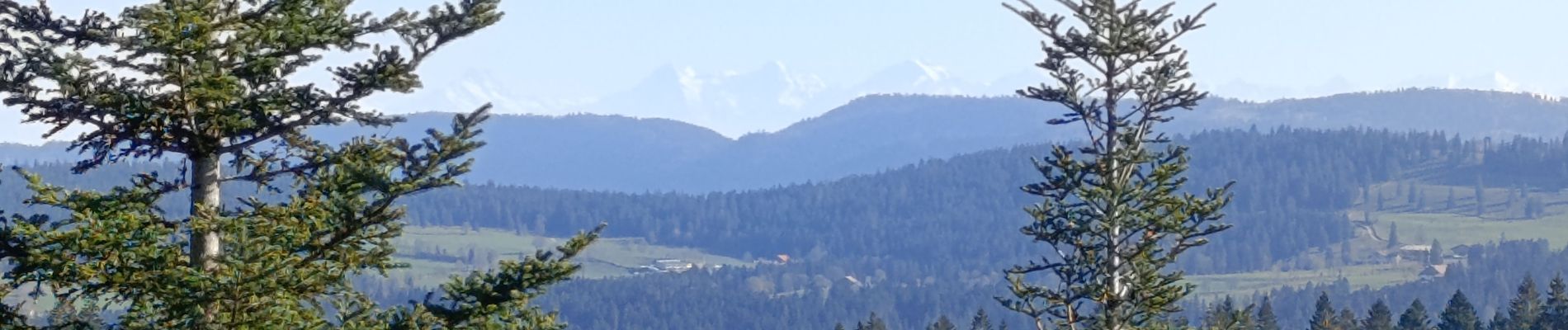
Mont Chateleu

billodmorelpatrick
User
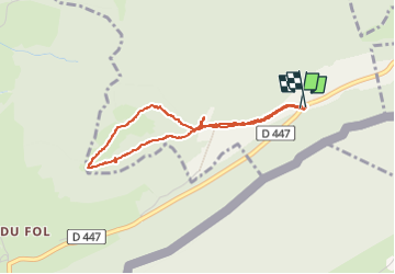

Length
3.4 km

Max alt
1289 m

Uphill gradient
97 m
Km-Effort
4.7 km

Min alt
1196 m

Downhill gradient
95 m
Boucle
Yes
Creation date :
2024-11-10 10:17:23.241
Updated on :
2024-11-10 13:09:32.51
2h25
Difficulty : Easy

FREE GPS app for hiking
 SityTrail
IGN / Geographical institutes
SityTrail Plus
The world is yours!
About
Trail Walking of 3.4 km to be discovered at Bourgogne-Franche-Comté, Doubs, Grand'Combe-Châteleu. This trail is proposed by billodmorelpatrick.
Photos

Positioning
Country:
France
Region :
Bourgogne-Franche-Comté
Department/Province :
Doubs
Municipality :
Grand'Combe-Châteleu
Location:
Unknown
Start:(Dec)
Start:(UTM)
316717 ; 5207181 (32T) N.
Comments