


2024-11-10_23h31m14_24 11 10 Montfrin-reco

DL72
User
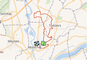

Length
17.5 km

Max alt
69 m

Uphill gradient
191 m
Km-Effort
20 km

Min alt
13 m

Downhill gradient
191 m
Boucle
Yes
Creation date :
2024-11-10 22:31:14.97
Updated on :
2024-11-10 22:36:22.407

FREE GPS app for hiking
 SityTrail
IGN / Geographical institutes
SityTrail Plus
The world is yours!
About
Trail of 17.5 km to be discovered at Occitania, Gard, Montfrin. This trail is proposed by DL72.
Positioning
Country:
France
Region :
Occitania
Department/Province :
Gard
Municipality :
Montfrin
Location:
Unknown
Start:(Dec)
Start:(UTM)
628558 ; 4859213 (31T) N.
Comments