


rivière St Louis - Cilaos

XavierFaidix
User
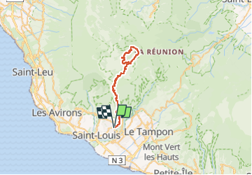

Length
61 km

Max alt
1419 m

Uphill gradient
3202 m
Km-Effort
104 km

Min alt
157 m

Downhill gradient
3202 m
Boucle
Yes
Creation date :
2024-11-11 03:15:44.042
Updated on :
2024-11-11 12:07:23.567
7h00
Difficulty : Difficult

FREE GPS app for hiking
 SityTrail
IGN / Geographical institutes
SityTrail Plus
The world is yours!
About
Trail Road bike of 61 km to be discovered at Réunion, Unknown, Saint-Louis. This trail is proposed by XavierFaidix.
Positioning
Country:
France
Region :
Réunion
Department/Province :
Unknown
Municipality :
Saint-Louis
Location:
Unknown
Start:(Dec)
Start:(UTM)
339004 ; 7647241 (40K) S.
Comments