


Amponville - Dolmen dit la Pierre Larmoire

guydu41
User


1h53
Difficulty : Very easy

FREE GPS app for hiking
 SityTrail
IGN / Geographical institutes
SityTrail Plus
The world is yours!
About
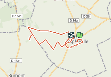
Trail Walking of 7.8 km to be discovered at Ile-de-France, Seine-et-Marne, Amponville. This trail is proposed by guydu41.
Description
Départ depuis le parking le long du Chemin des Manneries à Amponville 77760.
Le circuit contourne la grande Mare puis passe devant l’Église Notre-Dame-de-l’Assomption.
Après un parcours sur des chemins à travers champs, le circuit traverse un petit bois pour déboucher devant un champ avec le dolmen La Pierre Larmoire vieux de 5000 ans à une cinquantaine de mètres du bord du terrain.
Au retour vers le parking, le circuit emprunte un sentier à travers le Parc des Manneries.
Photos


22 photos in total. Please click on a photo to see them all in the gallery.
Positioning
Comments