


Bois de la Gaillarde

GeorgesV.
User
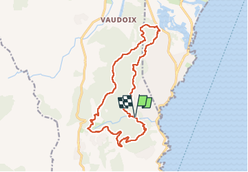

Length
18.1 km

Max alt
247 m

Uphill gradient
587 m
Km-Effort
26 km

Min alt
1 m

Downhill gradient
588 m
Boucle
Yes
Creation date :
2024-11-13 07:40:12.0
Updated on :
2024-11-13 14:28:24.232

FREE GPS app for hiking
 SityTrail
IGN / Geographical institutes
SityTrail Plus
The world is yours!
About
Trail of 18.1 km to be discovered at Provence-Alpes-Côte d'Azur, Var, Roquebrune-sur-Argens. This trail is proposed by GeorgesV..
Positioning
Country:
France
Region :
Provence-Alpes-Côte d'Azur
Department/Province :
Var
Municipality :
Roquebrune-sur-Argens
Location:
Unknown
Start:(Dec)
Start:(UTM)
313795 ; 4804326 (32T) N.
Comments