


parcours patrick

XavierFaidix
User
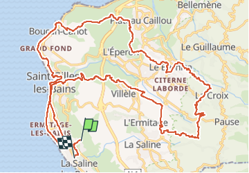

Length
46 km

Max alt
770 m

Uphill gradient
1086 m
Km-Effort
60 km

Min alt
0 m

Downhill gradient
1121 m
Boucle
No
Creation date :
2024-11-12 10:50:33.851
Updated on :
2024-11-13 14:39:27.651
3h30
Difficulty : Difficult

FREE GPS app for hiking
 SityTrail
IGN / Geographical institutes
SityTrail Plus
The world is yours!
About
Trail Mountain bike of 46 km to be discovered at Réunion, Unknown, Saint-Paul. This trail is proposed by XavierFaidix.
Description
eVTT
Positioning
Country:
France
Region :
Réunion
Department/Province :
Unknown
Municipality :
Saint-Paul
Location:
Unknown
Start:(Dec)
Start:(UTM)
316957 ; 7667759 (40K) S.
Comments