


Étang d’Ayès par Bethmale

lebarça
User
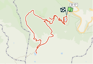

Length
15.1 km

Max alt
1729 m

Uphill gradient
810 m
Km-Effort
26 km

Min alt
1053 m

Downhill gradient
811 m
Boucle
Yes
Creation date :
2024-11-14 07:53:35.0
Updated on :
2024-11-14 14:25:33.342

FREE GPS app for hiking
 SityTrail
IGN / Geographical institutes
SityTrail Plus
The world is yours!
About
Trail of 15.1 km to be discovered at Occitania, Ariège, Bethmale. This trail is proposed by lebarça.
Positioning
Country:
France
Region :
Occitania
Department/Province :
Ariège
Municipality :
Bethmale
Location:
Unknown
Start:(Dec)
Start:(UTM)
343552 ; 4747384 (31T) N.
Comments