


* Pointe de Surgatte

chasle
User
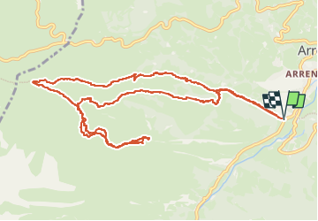

Length
14.5 km

Max alt
1813 m

Uphill gradient
933 m
Km-Effort
27 km

Min alt
911 m

Downhill gradient
933 m
Boucle
Yes
Creation date :
2024-11-14 07:43:35.726
Updated on :
2024-11-14 17:24:11.533
6h07
Difficulty : Difficult

FREE GPS app for hiking
 SityTrail
IGN / Geographical institutes
SityTrail Plus
The world is yours!
About
Trail Walking of 14.5 km to be discovered at Occitania, Hautespyrenees, Arrens-Marsous. This trail is proposed by chasle.
Positioning
Country:
France
Region :
Occitania
Department/Province :
Hautespyrenees
Municipality :
Arrens-Marsous
Location:
Unknown
Start:(Dec)
Start:(UTM)
726888 ; 4758978 (30T) N.
Comments