


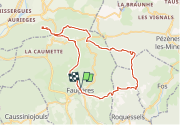
Les Moulins de Faugères - Pic de Tantajo

ARVIEU
User

Length
21 km

Max alt
505 m

Uphill gradient
647 m
Km-Effort
29 km

Min alt
254 m

Downhill gradient
648 m
Boucle
Yes
Creation date :
2024-11-15 07:45:20.424
Updated on :
2024-11-15 07:49:42.712
5h30
Difficulty : Medium

FREE GPS app for hiking
 SityTrail
IGN / Geographical institutes
SityTrail Plus
The world is yours!
About
Trail Walking of 21 km to be discovered at Occitania, Hérault, Faugères. This trail is proposed by ARVIEU.
Photos


Positioning
Country:
France
Region :
Occitania
Department/Province :
Hérault
Municipality :
Faugères
Location:
Unknown
Start:(Dec)
Start:(UTM)
515457 ; 4823656 (31T) N.
Comments