


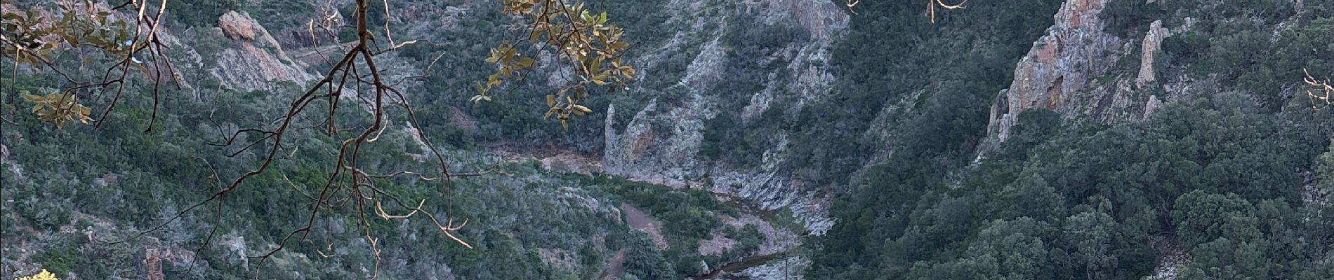
Perthus Occidental depuis la font du pommier

GeorgesV.
User
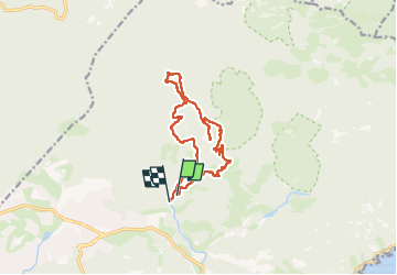

Length
13.4 km

Max alt
317 m

Uphill gradient
423 m
Km-Effort
19 km

Min alt
16 m

Downhill gradient
422 m
Boucle
No
Creation date :
2024-11-15 07:24:35.0
Updated on :
2024-11-15 12:23:17.931

FREE GPS app for hiking
 SityTrail
IGN / Geographical institutes
SityTrail Plus
The world is yours!
About
Trail of 13.4 km to be discovered at Provence-Alpes-Côte d'Azur, Var, Saint-Raphaël. This trail is proposed by GeorgesV..
Photos

Positioning
Country:
France
Region :
Provence-Alpes-Côte d'Azur
Department/Province :
Var
Municipality :
Saint-Raphaël
Location:
Unknown
Start:(Dec)
Start:(UTM)
325407 ; 4814066 (32T) N.
Comments