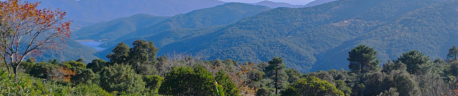
les sources de la Giscle

bernir
User
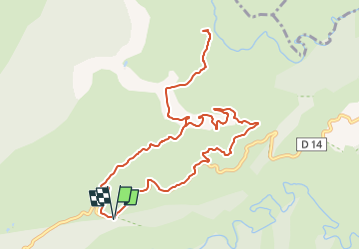

Length
11.9 km

Max alt
590 m

Uphill gradient
339 m
Km-Effort
16.4 km

Min alt
355 m

Downhill gradient
340 m
Boucle
Yes
Creation date :
2024-11-15 15:59:04.925
Updated on :
2024-11-15 16:36:23.272
3h43
Difficulty : Easy

FREE GPS app for hiking
 SityTrail
IGN / Geographical institutes
SityTrail Plus
The world is yours!
About
Trail Walking of 11.9 km to be discovered at Provence-Alpes-Côte d'Azur, Var, Collobrières. This trail is proposed by bernir.
Photos


Positioning
Country:
France
Region :
Provence-Alpes-Côte d'Azur
Department/Province :
Var
Municipality :
Collobrières
Location:
Unknown
Start:(Dec)
Start:(UTM)
286606 ; 4791314 (32T) N.
Comments