


17 11 2024 vttae gab gil

bebak
User
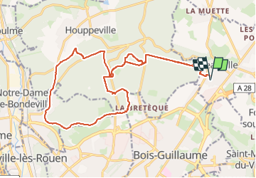

Length
23 km

Max alt
175 m

Uphill gradient
396 m
Km-Effort
28 km

Min alt
32 m

Downhill gradient
397 m
Boucle
Yes
Creation date :
2024-11-17 10:09:41.0
Updated on :
2024-11-17 11:53:37.939

FREE GPS app for hiking
 SityTrail
IGN / Geographical institutes
SityTrail Plus
The world is yours!
About
Trail of 23 km to be discovered at Normandy, Seine-Maritime, Isneauville. This trail is proposed by bebak.
Positioning
Country:
France
Region :
Normandy
Department/Province :
Seine-Maritime
Municipality :
Isneauville
Location:
Unknown
Start:(Dec)
Start:(UTM)
365271 ; 5484040 (31U) N.
Comments