


* Pic Lapeyre

chasle
User
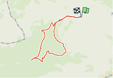

Length
9.7 km

Max alt
1819 m

Uphill gradient
653 m
Km-Effort
18.4 km

Min alt
1203 m

Downhill gradient
653 m
Boucle
Yes
Creation date :
2024-11-17 08:28:31.361
Updated on :
2024-11-17 16:34:37.95
4h11
Difficulty : Difficult

FREE GPS app for hiking
 SityTrail
IGN / Geographical institutes
SityTrail Plus
The world is yours!
About
Trail Walking of 9.7 km to be discovered at Occitania, Hautespyrenees, Bagnères-de-Bigorre. This trail is proposed by chasle.
Positioning
Country:
France
Region :
Occitania
Department/Province :
Hautespyrenees
Municipality :
Bagnères-de-Bigorre
Location:
Unknown
Start:(Dec)
Start:(UTM)
264812 ; 4767250 (31T) N.
Comments