


cornichesdu tarn mn 08 2024

georgein
User
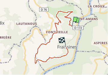

Length
7.8 km

Max alt
530 m

Uphill gradient
255 m
Km-Effort
11 km

Min alt
325 m

Downhill gradient
200 m
Boucle
No
Creation date :
2024-08-15 09:29:15.549
Updated on :
2024-11-17 15:18:19.057
2h18
Difficulty : Medium

FREE GPS app for hiking
 SityTrail
IGN / Geographical institutes
SityTrail Plus
The world is yours!
About
Trail Walking of 7.8 km to be discovered at Occitania, Tarn, Fraissines. This trail is proposed by georgein.
Positioning
Country:
France
Region :
Occitania
Department/Province :
Tarn
Municipality :
Fraissines
Location:
Unknown
Start:(Dec)
Start:(UTM)
461383 ; 4869063 (31T) N.
Comments