


st cezaire sur siagne

vincente204
User
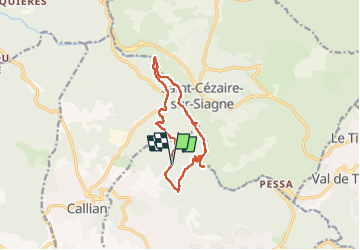

Length
12.3 km

Max alt
431 m

Uphill gradient
361 m
Km-Effort
17.1 km

Min alt
160 m

Downhill gradient
359 m
Boucle
Yes
Creation date :
2024-11-13 08:36:39.958
Updated on :
2024-11-19 14:32:17.604
6h01
Difficulty : Difficult

FREE GPS app for hiking
 SityTrail
IGN / Geographical institutes
SityTrail Plus
The world is yours!
About
Trail Walking of 12.3 km to be discovered at Provence-Alpes-Côte d'Azur, Var, Montauroux. This trail is proposed by vincente204.
Description
difficile
Positioning
Country:
France
Region :
Provence-Alpes-Côte d'Azur
Department/Province :
Var
Municipality :
Montauroux
Location:
Unknown
Start:(Dec)
Start:(UTM)
321111 ; 4833518 (32T) N.
Comments