


cote rouge

lionelnottat
User
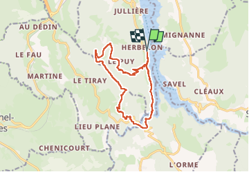

Length
14.5 km

Max alt
1040 m

Uphill gradient
755 m
Km-Effort
25 km

Min alt
480 m

Downhill gradient
755 m
Boucle
Yes
Creation date :
2024-11-19 08:07:49.578
Updated on :
2024-11-19 14:36:28.052
4h21
Difficulty : Very difficult

FREE GPS app for hiking
 SityTrail
IGN / Geographical institutes
SityTrail Plus
The world is yours!
About
Trail Walking of 14.5 km to be discovered at Auvergne-Rhône-Alpes, Isère, Treffort. This trail is proposed by lionelnottat.
Positioning
Country:
France
Region :
Auvergne-Rhône-Alpes
Department/Province :
Isère
Municipality :
Treffort
Location:
Unknown
Start:(Dec)
Start:(UTM)
711192 ; 4974705 (31T) N.
Comments