


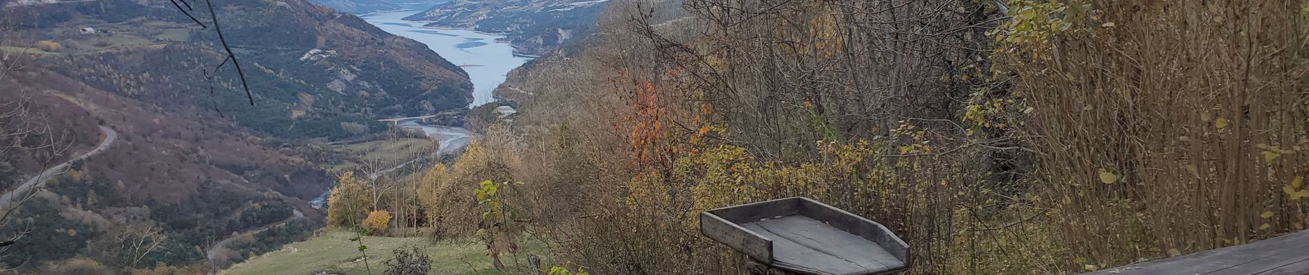
Le Lauzet-Ubaye col de la rousse 16kms 1157m

Danielba
User GUIDE
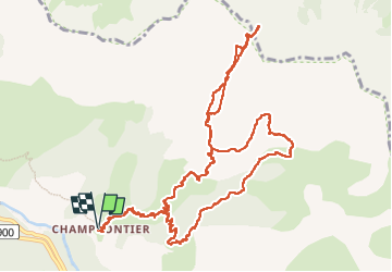

Length
14.7 km

Max alt
2149 m

Uphill gradient
1100 m
Km-Effort
29 km

Min alt
1175 m

Downhill gradient
1102 m
Boucle
Yes
Creation date :
2024-11-19 07:49:19.927
Updated on :
2024-11-19 19:10:58.625
7h33
Difficulty : Medium

FREE GPS app for hiking
 SityTrail
IGN / Geographical institutes
SityTrail Plus
The world is yours!
About
Trail Walking of 14.7 km to be discovered at Provence-Alpes-Côte d'Azur, Alpes-de-Haute-Provence, Le Lauzet-Ubaye. This trail is proposed by Danielba .
Photos


Positioning
Country:
France
Region :
Provence-Alpes-Côte d'Azur
Department/Province :
Alpes-de-Haute-Provence
Municipality :
Le Lauzet-Ubaye
Location:
Unknown
Start:(Dec)
Start:(UTM)
294632 ; 4924738 (32T) N.
Comments