


le clapier la pascalerie

lablaquiere
User
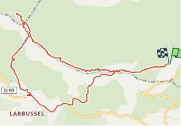

Length
7.6 km

Max alt
780 m

Uphill gradient
203 m
Km-Effort
10.3 km

Min alt
634 m

Downhill gradient
203 m
Boucle
Yes
Creation date :
2024-11-27 13:48:25.993
Updated on :
2024-11-27 16:26:00.221
2h08
Difficulty : Medium

FREE GPS app for hiking
 SityTrail
IGN / Geographical institutes
SityTrail Plus
The world is yours!
About
Trail Walking of 7.6 km to be discovered at Occitania, Aveyron, Cornus. This trail is proposed by lablaquiere.
Positioning
Country:
France
Region :
Occitania
Department/Province :
Aveyron
Municipality :
Cornus
Location:
Unknown
Start:(Dec)
Start:(UTM)
513888 ; 4854148 (31T) N.
Comments