


Arrens Marsous G3 2024 aulhe

LouisROGER
User GUIDE
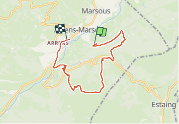

Length
7.9 km

Max alt
1347 m

Uphill gradient
468 m
Km-Effort
14.2 km

Min alt
871 m

Downhill gradient
499 m
Boucle
No
Creation date :
2024-11-29 09:08:51.843
Updated on :
2024-11-29 14:24:54.85
5h15
Difficulty : Difficult

FREE GPS app for hiking
 SityTrail
IGN / Geographical institutes
SityTrail Plus
The world is yours!
About
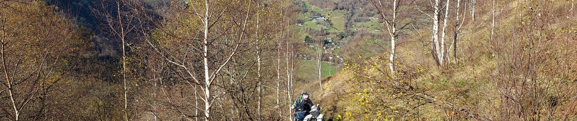
Trail Walking of 7.9 km to be discovered at Occitania, Hautespyrenees, Arrens-Marsous. This trail is proposed by LouisROGER.
Photos

Positioning
Country:
France
Region :
Occitania
Department/Province :
Hautespyrenees
Municipality :
Arrens-Marsous
Location:
Unknown
Start:(Dec)
Start:(UTM)
728227 ; 4759747 (30T) N.
Comments