


Le Ranquet-Istres 30.11.24

fredetpascale
User GUIDE
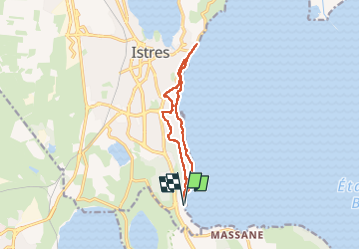

Length
11.7 km

Max alt
70 m

Uphill gradient
192 m
Km-Effort
14.2 km

Min alt
-1 m

Downhill gradient
190 m
Boucle
Yes
Creation date :
2024-11-30 10:07:42.737
Updated on :
2024-11-30 15:46:57.936
3h30
Difficulty : Easy

FREE GPS app for hiking
 SityTrail
IGN / Geographical institutes
SityTrail Plus
The world is yours!
About
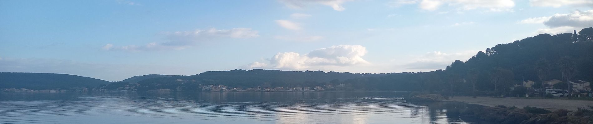
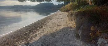
Trail Walking of 11.7 km to be discovered at Provence-Alpes-Côte d'Azur, Bouches-du-Rhône, Istres. This trail is proposed by fredetpascale.
Photos


Positioning
Country:
France
Region :
Provence-Alpes-Côte d'Azur
Department/Province :
Bouches-du-Rhône
Municipality :
Istres
Location:
Unknown
Start:(Dec)
Start:(UTM)
661779 ; 4815601 (31T) N.
Comments