


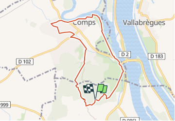
COMPS - ABBAYE DE St ROMAN

rando30129
User

Length
8.6 km

Max alt
90 m

Uphill gradient
110 m
Km-Effort
10 km

Min alt
8 m

Downhill gradient
109 m
Boucle
Yes
Creation date :
2024-11-30 19:48:29.805
Updated on :
2024-11-30 20:51:19.151
2h16
Difficulty : Medium

FREE GPS app for hiking
 SityTrail
IGN / Geographical institutes
SityTrail Plus
The world is yours!
About
Trail Walking of 8.6 km to be discovered at Occitania, Gard, Beaucaire. This trail is proposed by rando30129.
Positioning
Country:
France
Region :
Occitania
Department/Province :
Gard
Municipality :
Beaucaire
Location:
Unknown
Start:(Dec)
Start:(UTM)
629468 ; 4854565 (31T) N.
Comments