


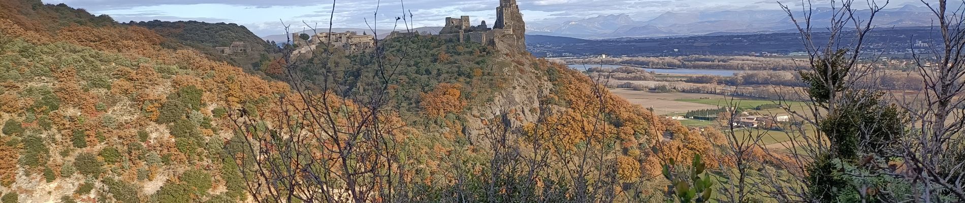
Rochemaure Pic Chenavari

Danielle07
User
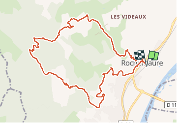

Length
13.5 km

Max alt
491 m

Uphill gradient
694 m
Km-Effort
23 km

Min alt
72 m

Downhill gradient
694 m
Boucle
Yes
Creation date :
2024-12-03 08:36:32.916
Updated on :
2025-01-18 15:01:27.259
5h10
Difficulty : Medium

FREE GPS app for hiking
 SityTrail
IGN / Geographical institutes
SityTrail Plus
The world is yours!
About
Trail Walking of 13.5 km to be discovered at Auvergne-Rhône-Alpes, Ardèche, Rochemaure. This trail is proposed by Danielle07.
Description
Parking à droite après le pont de la voie ferrée.
très beaux sentiers, sentier botanique sur le retour, très beau village médiéval à visiter au début et à la fin de la randonnée
Photos

Positioning
Country:
France
Region :
Auvergne-Rhône-Alpes
Department/Province :
Ardèche
Municipality :
Rochemaure
Location:
Unknown
Start:(Dec)
Start:(UTM)
635348 ; 4938433 (31T) N.
Comments