


Vercors Cras Scultures Vatilieu

c.gourme
User
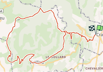

Length
16.2 km

Max alt
780 m

Uphill gradient
729 m
Km-Effort
26 km

Min alt
353 m

Downhill gradient
730 m
Boucle
Yes
Creation date :
2024-12-03 08:58:09.0
Updated on :
2024-12-07 15:25:34.817
5h29
Difficulty : Easy

FREE GPS app for hiking
 SityTrail
IGN / Geographical institutes
SityTrail Plus
The world is yours!
About
Trail Walking of 16.2 km to be discovered at Auvergne-Rhône-Alpes, Isère, Cras. This trail is proposed by c.gourme.
Description
Vercors Tullin Sculpture trajet plus Long et plus de dénivellé
Positioning
Country:
France
Region :
Auvergne-Rhône-Alpes
Department/Province :
Isère
Municipality :
Cras
Location:
Unknown
Start:(Dec)
Start:(UTM)
691871 ; 5015648 (31T) N.
Comments