


16.3

ARVIEU
User

Length
16.3 km

Max alt
413 m

Uphill gradient
356 m
Km-Effort
21 km

Min alt
155 m

Downhill gradient
358 m
Boucle
Yes
Creation date :
2024-12-04 19:53:54.679
Updated on :
2024-12-04 19:57:45.006
5h00
Difficulty : Medium

FREE GPS app for hiking
 SityTrail
IGN / Geographical institutes
SityTrail Plus
The world is yours!
About
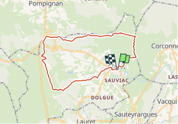
Trail Walking of 16.3 km to be discovered at Occitania, Hérault, Claret. This trail is proposed by ARVIEU.
Description
Départ de Claret.
Cette randonnée sur les crêtes dominant la plaine viticole de Claret vous conduit à l’oppidum du Rocher du Causse, par une succession de magnifiques points de vue.
Photos

Positioning
Country:
France
Region :
Occitania
Department/Province :
Hérault
Municipality :
Claret
Location:
Unknown
Start:(Dec)
Start:(UTM)
572851 ; 4856780 (31T) N.
Comments