


Puydaniel Mauressac fait 2025

pidjam
User
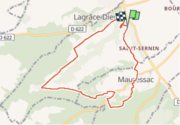

Length
9.9 km

Max alt
322 m

Uphill gradient
174 m
Km-Effort
12.2 km

Min alt
206 m

Downhill gradient
174 m
Boucle
Yes
Creation date :
2024-12-05 13:13:08.256
Updated on :
2024-12-05 15:52:41.553
2h20
Difficulty : Medium

FREE GPS app for hiking
 SityTrail
IGN / Geographical institutes
SityTrail Plus
The world is yours!
About
Trail Walking of 9.9 km to be discovered at Occitania, Haute-Garonne, Puydaniel. This trail is proposed by pidjam.
Positioning
Country:
France
Region :
Occitania
Department/Province :
Haute-Garonne
Municipality :
Puydaniel
Location:
Unknown
Start:(Dec)
Start:(UTM)
372898 ; 4799478 (31T) N.
Comments