


Clairan-B-1

ARVIEU
User

Length
13.2 km

Max alt
215 m

Uphill gradient
343 m
Km-Effort
17.8 km

Min alt
64 m

Downhill gradient
344 m
Boucle
Yes
Creation date :
2024-12-07 05:52:42.855
Updated on :
2024-12-07 05:57:30.279
4h00
Difficulty : Easy

FREE GPS app for hiking
 SityTrail
IGN / Geographical institutes
SityTrail Plus
The world is yours!
About
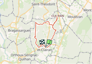
Trail Walking of 13.2 km to be discovered at Occitania, Gard, Cannes-et-Clairan. This trail is proposed by ARVIEU.
Positioning
Country:
France
Region :
Occitania
Department/Province :
Gard
Municipality :
Cannes-et-Clairan
Location:
Unknown
Start:(Dec)
Start:(UTM)
587184 ; 4861353 (31T) N.
Comments