


Mont Haut par Castillou depuis Montoulieu

34christophe
User
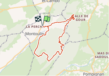

Length
17.6 km

Max alt
519 m

Uphill gradient
488 m
Km-Effort
24 km

Min alt
182 m

Downhill gradient
489 m
Boucle
Yes
Creation date :
2024-12-07 07:54:57.676
Updated on :
2024-12-07 07:58:14.24
6h00
Difficulty : Difficult

FREE GPS app for hiking
 SityTrail
IGN / Geographical institutes
SityTrail Plus
The world is yours!
About
Trail Walking of 17.6 km to be discovered at Occitania, Hérault, Montoulieu. This trail is proposed by 34christophe.
Positioning
Country:
France
Region :
Occitania
Department/Province :
Hérault
Municipality :
Montoulieu
Location:
Unknown
Start:(Dec)
Start:(UTM)
564108 ; 4864778 (31T) N.
Comments