


projet 3 Orléans

Le grand Claude
User

Length
356 km

Max alt
439 m

Uphill gradient
2609 m
Km-Effort
391 km

Min alt
46 m

Downhill gradient
2785 m
Boucle
No
Creation date :
2024-12-08 08:57:56.313
Updated on :
2024-12-11 19:47:18.409
23h41
Difficulty : Medium

FREE GPS app for hiking
 SityTrail
IGN / Geographical institutes
SityTrail Plus
The world is yours!
About
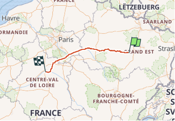
Trail Road bike of 356 km to be discovered at Grand Est, Vosges, Domrémy-la-Pucelle. This trail is proposed by Le grand Claude.
Description
Départ de Domremy-la-pucelle
à 138 km, Première Etape ARCIS-SUR-AUBE
à 238km deuxieme étape MONTEREAU-FAULT-YONNE
à 356 km troisiéme étape Orléans Parc des Expositions
Positioning
Country:
France
Region :
Grand Est
Department/Province :
Vosges
Municipality :
Domrémy-la-Pucelle
Location:
Unknown
Start:(Dec)
Start:(UTM)
697836 ; 5368897 (31U) N.
Comments