


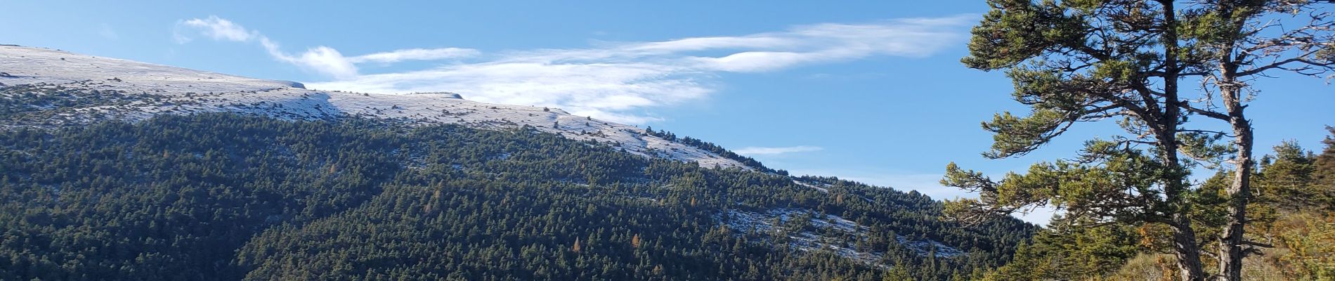
moriez parrioune grau de courchons 906m 16.5kms

Danielba
User GUIDE
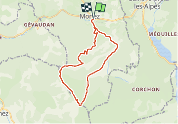

Length
16.1 km

Max alt
1621 m

Uphill gradient
806 m
Km-Effort
27 km

Min alt
884 m

Downhill gradient
805 m
Boucle
Yes
Creation date :
2024-12-08 07:40:57.792
Updated on :
2024-12-08 16:50:24.486
6h29
Difficulty : Medium

FREE GPS app for hiking
 SityTrail
IGN / Geographical institutes
SityTrail Plus
The world is yours!
About
Trail Walking of 16.1 km to be discovered at Provence-Alpes-Côte d'Azur, Alpes-de-Haute-Provence, Moriez. This trail is proposed by Danielba .
Photos


Positioning
Country:
France
Region :
Provence-Alpes-Côte d'Azur
Department/Province :
Alpes-de-Haute-Provence
Municipality :
Moriez
Location:
Unknown
Start:(Dec)
Start:(UTM)
297168 ; 4870644 (32T) N.
Comments