


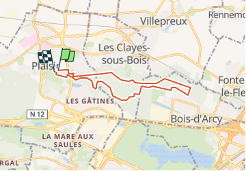
SityTrail - 2023-12-14-Ch-Plaisir-bois-Ste-Apoline-m

Rando MLC
User

Length
12.2 km

Max alt
188 m

Uphill gradient
144 m
Km-Effort
14.2 km

Min alt
112 m

Downhill gradient
143 m
Boucle
Yes
Creation date :
2024-12-09 13:50:45.131
Updated on :
2024-12-09 13:51:30.016
3h13
Difficulty : Difficult

FREE GPS app for hiking
 SityTrail
IGN / Geographical institutes
SityTrail Plus
The world is yours!
About
Trail Walking of 12.2 km to be discovered at Ile-de-France, Yvelines, Plaisir. This trail is proposed by Rando MLC.
Positioning
Country:
France
Region :
Ile-de-France
Department/Province :
Yvelines
Municipality :
Plaisir
Location:
Unknown
Start:(Dec)
Start:(UTM)
423219 ; 5407494 (31U) N.
Comments