


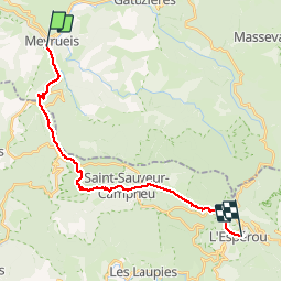
GR6-62-7 Meyrueis-Esperou

mozzipsc
User

Length
23 km

Max alt
1334 m

Uphill gradient
973 m
Km-Effort
34 km

Min alt
705 m

Downhill gradient
444 m
Boucle
No
Creation date :
2015-06-04 00:00:00.0
Updated on :
2015-06-04 00:00:00.0
6h11
Difficulty : Difficult

FREE GPS app for hiking
 SityTrail
IGN / Geographical institutes
SityTrail Plus
The world is yours!
About
Trail Walking of 23 km to be discovered at Occitania, Lozère, Meyrueis. This trail is proposed by mozzipsc.
Description
Grosse montée après Meyrueis, traversée de forêts, petite déviation sur St-Sauveur, chemin de campagne avant la montée sur L'Esperou.
Positioning
Country:
France
Region :
Occitania
Department/Province :
Lozère
Municipality :
Meyrueis
Location:
Unknown
Start:(Dec)
Start:(UTM)
534237 ; 4891674 (31T) N.
Comments