


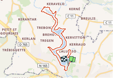
Moulin de Pen mur Muzillac

med88
User

Length
10.6 km

Max alt
38 m

Uphill gradient
149 m
Km-Effort
12.5 km

Min alt
6 m

Downhill gradient
143 m
Boucle
Yes
Creation date :
2024-12-12 08:30:08.174
Updated on :
2024-12-12 11:59:05.918
2h52
Difficulty : Medium

FREE GPS app for hiking
 SityTrail
IGN / Geographical institutes
SityTrail Plus
The world is yours!
About
Trail Walking of 10.6 km to be discovered at Brittany, Morbihan, Muzillac. This trail is proposed by med88.
Positioning
Country:
France
Region :
Brittany
Department/Province :
Morbihan
Municipality :
Muzillac
Location:
Unknown
Start:(Dec)
Start:(UTM)
538198 ; 5267763 (30T) N.
Comments