


Montbéliard

PatriceCocuaud
User

Length
25 km

Max alt
471 m

Uphill gradient
384 m
Km-Effort
30 km

Min alt
313 m

Downhill gradient
377 m
Boucle
No
Creation date :
2024-12-12 16:31:32.696
Updated on :
2024-12-12 20:57:27.213
4h25
Difficulty : Very difficult

FREE GPS app for hiking
 SityTrail
IGN / Geographical institutes
SityTrail Plus
The world is yours!
About
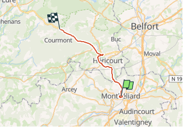
Trail Walking of 25 km to be discovered at Bourgogne-Franche-Comté, Doubs, Montbéliard. This trail is proposed by PatriceCocuaud.
Positioning
Country:
France
Region :
Bourgogne-Franche-Comté
Department/Province :
Doubs
Municipality :
Montbéliard
Location:
Unknown
Start:(Dec)
Start:(UTM)
334268 ; 5264158 (32T) N.
Comments