


2024-12-15_17h34m48_fouran (tête de par ravin du clot)

orsel
User GUIDE
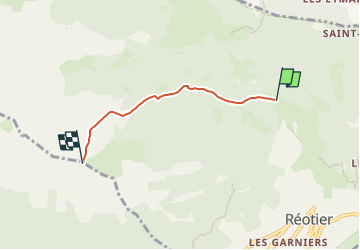

Length
3.4 km

Max alt
2443 m

Uphill gradient
934 m
Km-Effort
12.7 km

Min alt
1500 m

Downhill gradient
0 m
Boucle
No
Creation date :
2024-12-15 16:34:48.525
Updated on :
2024-12-15 16:34:49.075

FREE GPS app for hiking
 SityTrail
IGN / Geographical institutes
SityTrail Plus
The world is yours!
About
Trail of 3.4 km to be discovered at Provence-Alpes-Côte d'Azur, Hautes-Alpes, Réotier. This trail is proposed by orsel.
Positioning
Country:
France
Region :
Provence-Alpes-Côte d'Azur
Department/Province :
Hautes-Alpes
Municipality :
Réotier
Location:
Unknown
Start:(Dec)
Start:(UTM)
308463 ; 4950317 (32T) N.
Comments