


Barnas

Rudy07
User
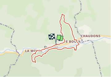

Length
8.2 km

Max alt
582 m

Uphill gradient
315 m
Km-Effort
12.3 km

Min alt
438 m

Downhill gradient
305 m
Boucle
Yes
Creation date :
2024-12-18 12:31:13.15
Updated on :
2024-12-20 15:17:29.292
2h48
Difficulty : Difficult

FREE GPS app for hiking
 SityTrail
IGN / Geographical institutes
SityTrail Plus
The world is yours!
About
Trail Walking of 8.2 km to be discovered at Auvergne-Rhône-Alpes, Ardèche, Barnas. This trail is proposed by Rudy07.
Description
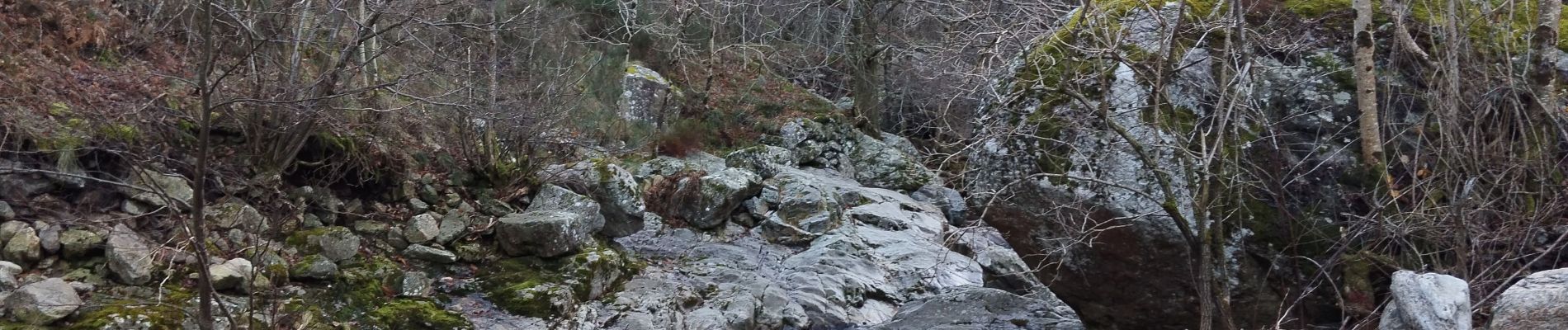
Chemin botanique, Champ Hago, pont du Sigadou, Planchette. Retour.
Photos


Positioning
Country:
France
Region :
Auvergne-Rhône-Alpes
Department/Province :
Ardèche
Municipality :
Barnas
Location:
Unknown
Start:(Dec)
Start:(UTM)
592592 ; 4946783 (31T) N.
Comments