


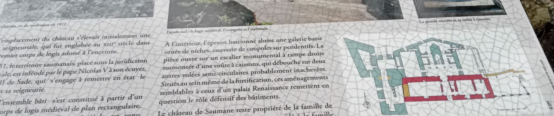
saumane et ses environs

FLORENSAC
User


Length
13.4 km

Max alt
470 m

Uphill gradient
466 m
Km-Effort
19.6 km

Min alt
185 m

Downhill gradient
472 m
Boucle
Yes
Creation date :
2024-12-19 09:08:48.273
Updated on :
2024-12-19 15:06:55.408
5h57
Difficulty : Very difficult

FREE GPS app for hiking
 SityTrail
IGN / Geographical institutes
SityTrail Plus
The world is yours!
About
Trail Walking of 13.4 km to be discovered at Provence-Alpes-Côte d'Azur, Vaucluse, Saumane-de-Vaucluse. This trail is proposed by FLORENSAC.
Description
de belles formations geologiques tout le long du parcours
Photos


Positioning
Country:
France
Region :
Provence-Alpes-Côte d'Azur
Department/Province :
Vaucluse
Municipality :
Saumane-de-Vaucluse
Location:
Unknown
Start:(Dec)
Start:(UTM)
669148 ; 4867240 (31T) N.
Comments
super boucle n oubliez pas le GPS