


smp03

PasGoe
User

Length
9.1 km

Max alt
223 m

Uphill gradient
81 m
Km-Effort
10.2 km

Min alt
191 m

Downhill gradient
87 m
Boucle
No
Creation date :
2024-12-19 14:41:53.664
Updated on :
2024-12-19 16:33:45.87
1h51
Difficulty : Medium

FREE GPS app for hiking
 SityTrail
IGN / Geographical institutes
SityTrail Plus
The world is yours!
About
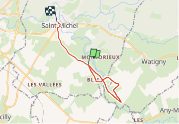
Trail Walking of 9.1 km to be discovered at Hauts-de-France, Aisne, Saint-Michel. This trail is proposed by PasGoe.
Positioning
Country:
France
Region :
Hauts-de-France
Department/Province :
Aisne
Municipality :
Saint-Michel
Location:
Unknown
Start:(Dec)
Start:(UTM)
582850 ; 5528288 (31U) N.
Comments