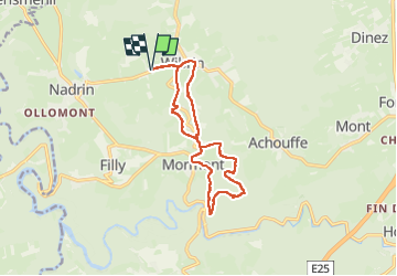
Trail Walking Houffalize - Wibrin - Photo
 Geert H.
Geert H.

User

© OpenStreetMap contributors
Length
Length
12 km
Max alt
Max alt
424 m
Uphill gradient
Uphill gradient
274 m
Km-Effort
Km-Effort  
15.6 km
Min alt
Min alt
302 m
Downhill gradient
Downhill gradient
275 m
Boucle
Boucle
Yes
Creation date :
2024-12-27 12:06:35.359
Updated on :
2024-12-27 18:30:56.572

(0 Reviews)

Walking
Walking
2h35
Difficulty : Medium

Scan this QR Code to open this trail in the SityTrail application

FREE GPS app for hiking

Logo SityTrail SityTrail

IGN / Geographical institutes

Download SityTrail from the App Store Download SityTrail from Google Play

Logo SityTrail SityTrail Plus

The world is yours!

Download SityTrail from the App Store Download SityTrail from Google Play Download SityTrail on Huawei AppGallery

About

Trail Walking of 12 km to be discovered at Wallonia, Luxembourg, Houffalize. This trail is proposed by Geert H..

Description

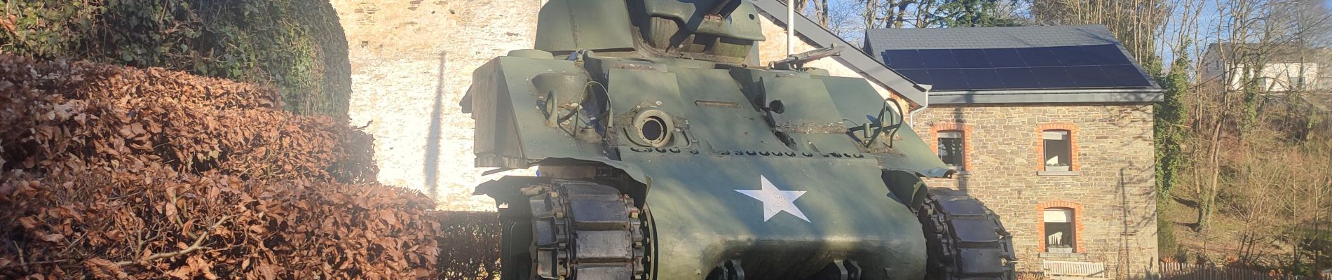
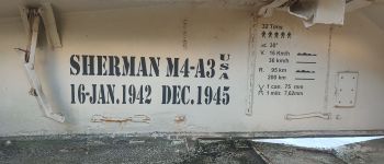
De Belle Meuse - De Amerikaanse tank in Wibrin

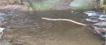
Gebaseerd op de wandeling 13 uit het Groot wandelboek Ardennen. Maar spijtig genoeg is op de plaats waar je de Belle Meuse moet oversteken volgens de beschrijving geen brug maar een waadplaats. Misschien werkt dit in de zomer als de rivier wat lager staat, maar in december stond deze te hoog en te wild. In plaats van Achouffe moesten we dus noodgedwongen de weg naar Mormont volgen. Maar de uitzichten zijn ook daar ook mooi. Een aanrader is de ons begin en eindpunt, de bistro Charme de Wibrin. Zeer lekker eten en een beleving op zich.

Elevation profile

Photos

Points of interest

Point of interest Houffalize - Ford, but no bridge - Photo
Geert H.
Point of interest Houffalize - Sherman tank - Photo
Geert H.
HOUFFALIZE 

Positioning

Country:
Belgium
Region :
Wallonia
Department/Province :
Luxembourg
Municipality :
Houffalize
Location:
Unknown
Start:(UTM)
693262 ; 5560429 (31U) N.


Close
My subscriptions