


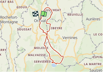
orcival a servieres

lol63
User

Length
14.8 km

Max alt
1226 m

Uphill gradient
434 m
Km-Effort
21 km

Min alt
870 m

Downhill gradient
435 m
Boucle
Yes
Creation date :
2025-01-01 10:25:31.076
Updated on :
2025-01-01 14:10:04.893
3h21
Difficulty : Medium

FREE GPS app for hiking
 SityTrail
IGN / Geographical institutes
SityTrail Plus
The world is yours!
About
Trail Walking of 14.8 km to be discovered at Auvergne-Rhône-Alpes, Puy-de-Dôme, Orcival. This trail is proposed by lol63.
Positioning
Country:
France
Region :
Auvergne-Rhône-Alpes
Department/Province :
Puy-de-Dôme
Municipality :
Orcival
Location:
Unknown
Start:(Dec)
Start:(UTM)
487702 ; 5058861 (31T) N.
Comments