


Pic de Paloumère par les Crêtes

lebarça
User
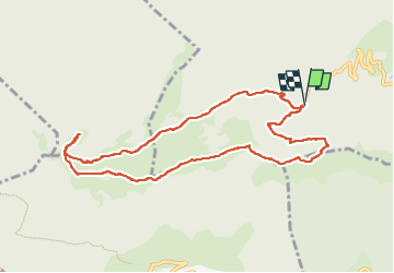

Length
10.3 km

Max alt
1594 m

Uphill gradient
592 m
Km-Effort
18.2 km

Min alt
1206 m

Downhill gradient
592 m
Boucle
Yes
Creation date :
2025-01-01 09:41:14.0
Updated on :
2025-01-01 14:30:40.539

FREE GPS app for hiking
 SityTrail
IGN / Geographical institutes
SityTrail Plus
The world is yours!
About
Trail of 10.3 km to be discovered at Occitania, Haute-Garonne, Herran. This trail is proposed by lebarça.
Positioning
Country:
France
Region :
Occitania
Department/Province :
Haute-Garonne
Municipality :
Herran
Location:
Unknown
Start:(Dec)
Start:(UTM)
327001 ; 4759057 (31T) N.
Comments