


Bos van Ename (Oudenaarde)

Geert H.
User

Length
6.6 km

Max alt
65 m

Uphill gradient
100 m
Km-Effort
7.9 km

Min alt
7 m

Downhill gradient
101 m
Boucle
Yes
Creation date :
2025-01-04 13:15:10.369
Updated on :
2025-01-04 17:18:56.745
1h48
Difficulty : Medium

FREE GPS app for hiking
 SityTrail
IGN / Geographical institutes
SityTrail Plus
The world is yours!
About
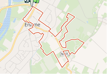
Trail Walking of 6.6 km to be discovered at Flanders, East Flanders, Oudenaarde. This trail is proposed by Geert H..
Description
Een reis door ons bosverleden
PAM Ename - Bos 't Ename - Katteberg
Gebaseerd op wandeling 58 uit het Groot Wandelboek Vlaanderen
Photos
 - Photo 1")
 - Photo 2")
 - Photo 3")
 - Photo 4")
 - Photo 5")
 - Photo 6")
 - Photo 7")
 - Photo 8")
 - Photo 9")
Positioning
Country:
Belgium
Region :
Flanders
Department/Province :
East Flanders
Municipality :
Oudenaarde
Location:
Ename
Start:(Dec)
Start:(UTM)
544499 ; 5634278 (31U) N.
Comments