


Croix de Provence:

ARPF1
User

Length
13.4 km

Max alt
909 m

Uphill gradient
742 m
Km-Effort
23 km

Min alt
257 m

Downhill gradient
742 m
Boucle
Yes
Creation date :
2025-01-08 10:06:30.572
Updated on :
2025-01-08 10:08:26.788
5h17
Difficulty : Very difficult

FREE GPS app for hiking
 SityTrail
IGN / Geographical institutes
SityTrail Plus
The world is yours!
About
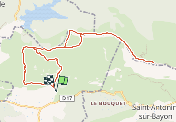
Trail Walking of 13.4 km to be discovered at Provence-Alpes-Côte d'Azur, Bouches-du-Rhône, Beaurecueil. This trail is proposed by ARPF1.
Positioning
Country:
France
Region :
Provence-Alpes-Côte d'Azur
Department/Province :
Bouches-du-Rhône
Municipality :
Beaurecueil
Location:
Unknown
Start:(Dec)
Start:(UTM)
705891 ; 4822133 (31T) N.
Comments