


Malpasset nordiques

LEDUNC
User
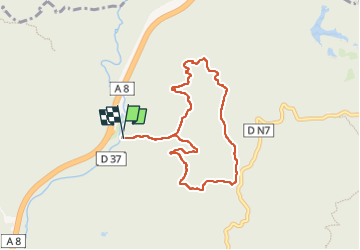

Length
7.9 km

Max alt
195 m

Uphill gradient
207 m
Km-Effort
10.6 km

Min alt
37 m

Downhill gradient
202 m
Boucle
Yes
Creation date :
2025-01-09 08:20:56.005
Updated on :
2025-01-09 09:48:09.457
1h21
Difficulty : Very easy

FREE GPS app for hiking
 SityTrail
IGN / Geographical institutes
SityTrail Plus
The world is yours!
About
Trail Nordic walking of 7.9 km to be discovered at Provence-Alpes-Côte d'Azur, Var, Fréjus. This trail is proposed by LEDUNC.
Description
rando sur les pistes
Positioning
Country:
France
Region :
Provence-Alpes-Côte d'Azur
Department/Province :
Var
Municipality :
Fréjus
Location:
Unknown
Start:(Dec)
Start:(UTM)
318743 ; 4818666 (32T) N.
Comments