


crest croix du bezot cobonne aouste

Joel26400
User
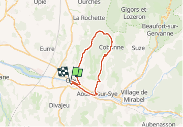

Length
22 km

Max alt
605 m

Uphill gradient
568 m
Km-Effort
30 km

Min alt
184 m

Downhill gradient
567 m
Boucle
Yes
Creation date :
2025-01-09 06:51:49.838
Updated on :
2025-01-09 14:23:33.123
5h59
Difficulty : Very difficult

FREE GPS app for hiking
 SityTrail
IGN / Geographical institutes
SityTrail Plus
The world is yours!
About
Trail Walking of 22 km to be discovered at Auvergne-Rhône-Alpes, Drôme, Crest. This trail is proposed by Joel26400.
Description
beau cirque
Positioning
Country:
France
Region :
Auvergne-Rhône-Alpes
Department/Province :
Drôme
Municipality :
Crest
Location:
Unknown
Start:(Dec)
Start:(UTM)
660048 ; 4954426 (31T) N.
Comments