


Plo del Naou

lebarça
User
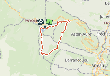

Length
11.6 km

Max alt
1744 m

Uphill gradient
675 m
Km-Effort
21 km

Min alt
1132 m

Downhill gradient
676 m
Boucle
Yes
Creation date :
2025-01-12 08:42:33.0
Updated on :
2025-01-12 14:15:15.565

FREE GPS app for hiking
 SityTrail
IGN / Geographical institutes
SityTrail Plus
The world is yours!
About
Trail of 11.6 km to be discovered at Occitania, Hautespyrenees, Campan. This trail is proposed by lebarça.
Positioning
Country:
France
Region :
Occitania
Department/Province :
Hautespyrenees
Municipality :
Campan
Location:
Unknown
Start:(Dec)
Start:(UTM)
279675 ; 4757247 (31T) N.
Comments