


2025-01-13_16h13m59_GR 221- 1 a- Port d'Andratx- Sant Elm

orsel
User GUIDE
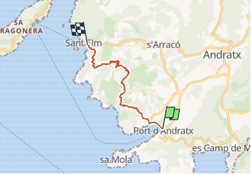

Length
8.3 km

Max alt
311 m

Uphill gradient
372 m
Km-Effort
13.3 km

Min alt
-1 m

Downhill gradient
363 m
Boucle
No
Creation date :
2025-01-13 15:13:59.637
Updated on :
2025-01-13 15:14:00.765

FREE GPS app for hiking
 SityTrail
IGN / Geographical institutes
SityTrail Plus
The world is yours!
About
Trail of 8.3 km to be discovered at Balearic Islands, Unknown, Andratx. This trail is proposed by orsel.
Positioning
Country:
Spain
Region :
Balearic Islands
Department/Province :
Unknown
Municipality :
Andratx
Location:
Unknown
Start:(Dec)
Start:(UTM)
447641 ; 4377575 (31S) N.
Comments